Participatory Modelling Apps #
Bushmeat Paraecology Data Exploration
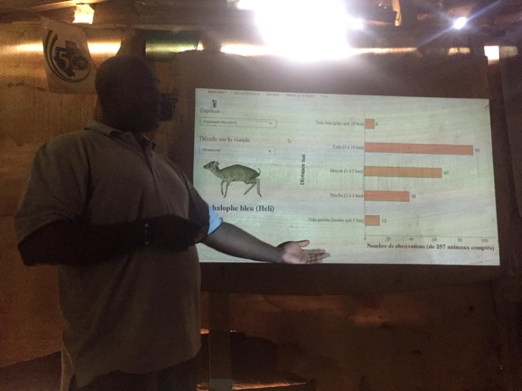
Communities use this tool to explore trends in their hunting and use of bushmeat from the data they collected with paraecologists. It enables active engagement with the data they find most interesting and important, rather than the status quo of outside researchers selecting key points and returning them to communities in static form (e.g., as posters).
Community Mapping of their Forests
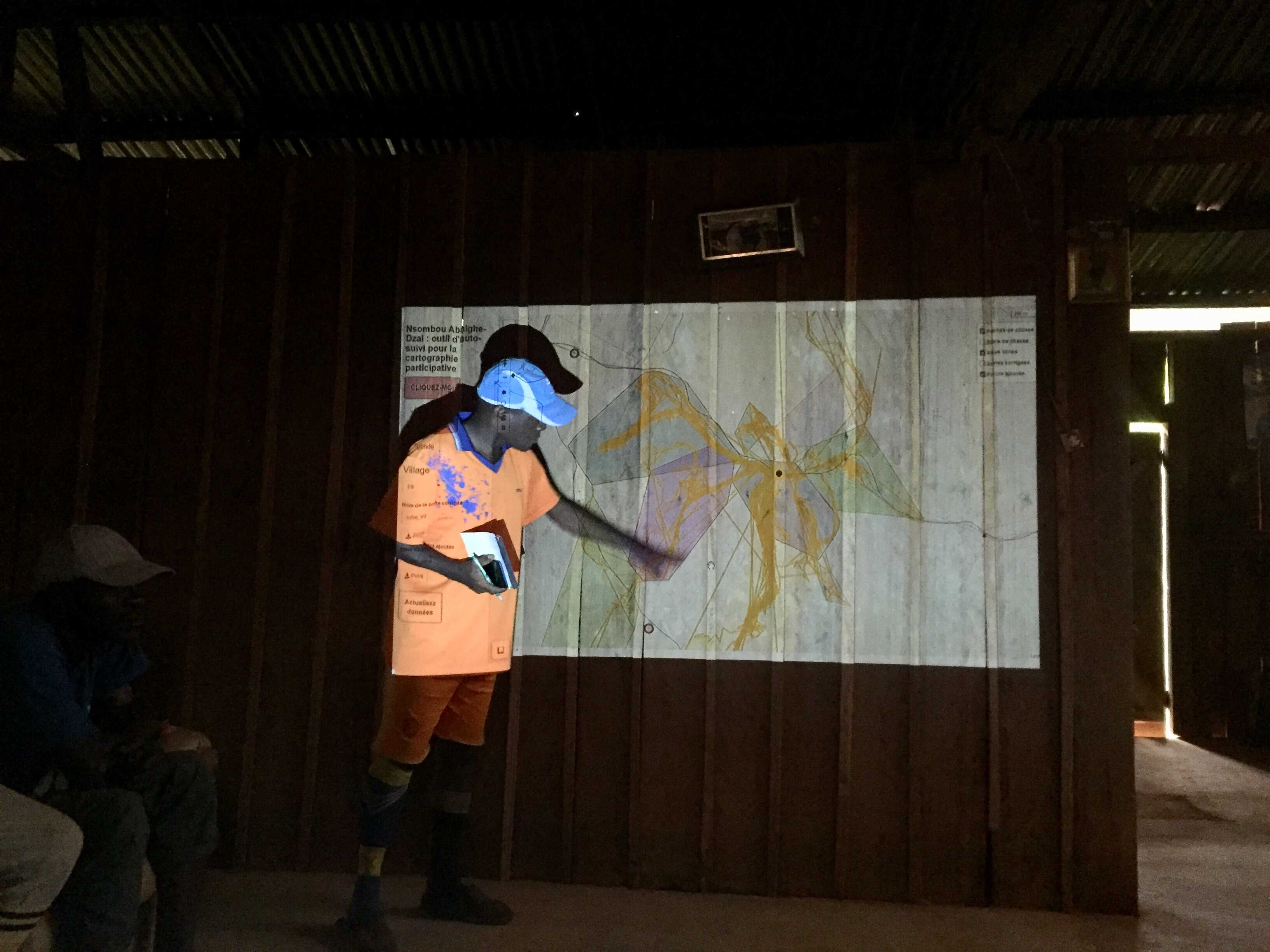
This tool combines community hunter self-follows with conventional participatory cartography to map their hunting areas and forest lands in general. It maximizes both the extent and detail of mapping by merging the knowledge of community members with the vast quantity of spatial information they gather through simple GPS technology.
Hunting Management Forecasting Tool
This forecasting tool, the PABBM (Participatory Agent-Based Bayesian Model), enables communities to simulate the effects of potential management decision-making on their hunting offtake and wildlife population and adapt their actions accordingly over time. The PABBM is a statistical innovation, weaving together the traditionally disparate worlds of agent-based and hierarchical Bayesian modelling. It’s still in development (see below image!), so please check in later.